


The Southern Peak District
Off Road at Dovedale
We parked in the public car park just up the road from the Izaak Walton Hotel. There is a small cabin selling icecream and a local map, as well as toilets. The path up the valley is well worn. After passing a weir on the right hand side, you can either walk up a surfaced road (past another ice cream van) or cross the river onto a rougher path on the other side of the valley. Both paths lead to the stepping stones at the foot of Thorpe Cloud. On a busy day, you can wait a while to cross the river here. From the stepping stones, only the eastern bank is open to the public.
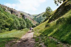
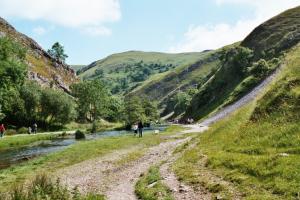
The first two pictures show the rougher path on the east bank of the river. Even so, this is not particularly challenging for most people. The slopes on the right hand side belong to Thorpe Cloud.
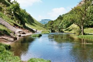
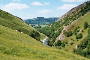
The third picture is also taken on the eastern path, this time looking south to where the Dove Valley emerges into the Manifold Valley. The path in the centre-left of the picture is about as challenging as it gets!
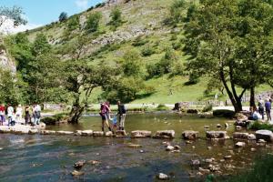
In the fourth picture, we see the stepping stones across the river. In conditions like these, they are easily negotiated by most people. We even managed to get our dog across there!
Our next challenge was to climb Thorpe Cloud and the next few pictures were taken on the route to the top. It is a steep path, but not particularly high. The views are well worth the effort, as the pictures demonstrate.
The path up the hill climbs the north face, so our first shot is taken looking north-west up Dovedale, beyond the stepping stones, which are just out of sight in the bottom left hand corner. Though not particularly high up, you get a different perspective on Dovedale from this location.
The next picture is taken from a similar location, looking over the shoulder of the hill south through Dovedale.

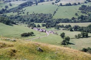
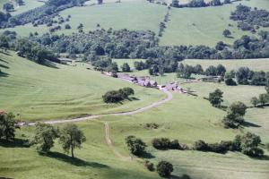
As we climb higher, the view to the south opens out more, and we catch our first glimpse of the area south of Dovedale though which we drove on our way here. The farm is (I think) Thorpe Mill Farm.
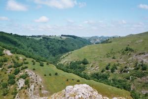
As we gain height, we lose sight of the river within Dovedale, but we can still pick out the course of the valley as it meanders between the hills.
Our final two pictures show the contrast between the view from the top of Thorpe Cloud and the view from the valley floor. In the first, we get a more open view of Thorpe Mill Farm, and the minor road between Ilam and Thorpe that runs through the middle of it.
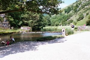
In the second we return to the valley floor near the stepping stones where we see visitors enjoying the river.
Not much in the way of Rural Roads on this page, apart from the view of a road from the top of the hill. Still, I hope you think these pictures were worth seeing.