


Collapse of a Road
The Former A625 at Mam Tor
Others have already given a potted history of the failure of this section of the A625 - see
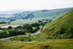
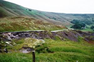
We start with some general shots of the area. The first is taken from the bus turning circle at the top of the closed section near the entrance to the Blue John Cavern. Here, we are looking towards the other open section further down the hill.
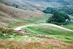
From the same location, our second picture is taken looking north east towards the old hairpin. This section is closed to general traffic, but part of it gives access to a farm. The hairpin doesn't look too bad, but just this side of it we get a hint of the full magnitude of the problem.
I climbed a little way up the hill to get the next two shots, which look back towards the upper bus turning circle, which is visible centre-left in the left hand picture. Oh, and when I describe it as a bus turning circle, we're not talking about bendy-buses, or even a standard coach. It is a local minibus that presumably does the tourist route through Winnats Pass and to the local caverns.
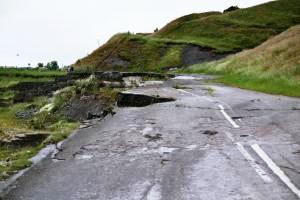
The left hand picture also shows how the road was repaired whilst still open to traffic - you can see how the white lines have been moved to highlight where the road goes.
The right hand picture also looks back towards the turning circle, but from lower down the hill. The road is still open as a cycle route, but you'd need to be fairly dedicated to try and ride it all. I don't think I've ever seen a cyclist use such a low gear as the one that road up the right hand side of the step in the middle of the picture.
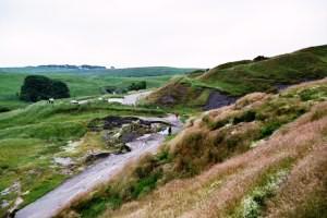
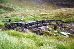
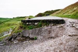
The next two pictures are taken from the bus turning circle, and illustrate the efforts to which the Highway Authority went to keep the road open before finally giving up. The left hand picture is a particularly good example of how many layers of surfacing have been placed here to maintain the road levels over the years.
The right hand shot is taken from the same place, and looks further along the closed section of road.
There is more detail in these shots. Again, you can see multiple layers of surfacing, and get a good impression of how the road continues to slide down the hillside.
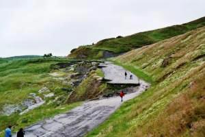
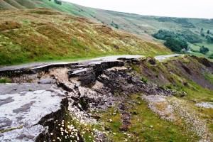
The right hand shot shows the edge of the road cracking up. I wonder how long it will be before this bit falls over the edge?
In the left hand picture below, we see the step that we saw from further back earlier in this tour. The right hand picture shows the point where the white lines have been marked and then re-marked to reflect where the road goes at a particular time.
I hope you've enjoyed our whistlestop tour of the Mam Tor landslip. Don't forget to visit the other sites listed at the top of the page.