Rural Roads Home Rural Roads Logo
British Roads

Northern England

  • A6 Shap Summit
  • A6024 - Holme Moss
  • Lake District Passes

Midlands

  • M45 Heritage Motorway
  • The Fosse Way
  • Southern Peak District
  • Winnats Pass & A625

Southern England

  • B1106 and Fornham
  • Cheddar Gorge
  • Cornish Coast
  • Dartmoor
  • East Hertfordshire
  • Exmoor Coast
  • New Forest
  • North Essex

Wales

  • Gower
  • Brecon to Hirwaun

Scotland (New)

  • Glen Nevis
  • Great Glen
  • Loch Ness - Errogie to Inverness
European Roads
  • European Menu


The Old Map Site Home

Rural Roads is pleased to support the Toybox Charity working with street children in Latin America

Links


Contact Me

Comments, contributions, Criticisms - please click here


Valid XHTML 1.0 Transitional

Valid CSS!

Get Firefox!

The Exmoor Coast

The Lynmouth Flood

Lynmouth Bridges

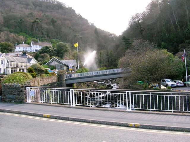
This picture is taken from the bridge on the harbour road, looking up-river towards the bridge
carrying the B3234 over the river.

Back


Exmoor Coast - Introduction
Exmoor Coast - West from Minehead
Exmoor Coast - Porlock Village
Exmoor Coast - Porlock Hill
Exmoor Coast - From Porlock Hill to Devon
Exmoor Coast - The Impenetrable Coast
Exmoor Coast - Lynton and Lynmouth
Exmoor Coast - The Lynmouth Flood
Exmoor Coast - Lynton and Lynmouth Cliff Railway

Rural Roads Home


Copyright © 2006 Simon Davies