


The Exmoor Coast
The Lynmouth Flood
Lynmouth was changed for ever on Friday 15th August, 1952. That night, the village was devastated by flooding, and 16 people lost their lives in Lynmouth. Another 18 lost their lives in the surrounding areas of Exmoor. Lynmouth is built at the mouth of the Lyn Gorge, where the East Lyn and West Lyn rivers reach the sea. The rivers drain the high plateau of Exmoor, reaching heights of up to 1500 feet. Approximately 10 inches of rain fell in the district on the 15th August and this, coupled with the extensive rainfall over the fortnight before, meant that there was nowhere for this rain water to go.
The rivers quickly burst their banks, and water levels continued to rise as the rain water drained from the moor. The steep valleys meant that the water was not only deep, but fast moving – sweeping away trees, bridges and other large items. These served to increase the devastation in the Lyn Gorge. There was nothing that could stop this wave of destruction. Around 100 buildings in Lynmouth were damaged – many of which were completely shattered. Cars were swept out to see, and the massive harbour wall was undermined by the power of the river. Lynmouth was re-built, but the new channels carved out by the flood water were retained, and widened to reduce the likelihood of disaster on a similar scale in the future. The Lynmouth Memorial Hall, built following the disaster, contains a permanent exhibition marking the flood, including a scale model of Lynmouth prior to the flood.
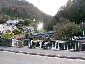
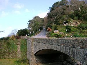
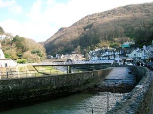
The first picture is taken from the bridge on the harbour road, looking up-river towards the bridge carrying the B3234 over the river. In the background, next to the yellow flag is a huge jet of water. I've no idea what that was as I didn't have time to go and investigate.
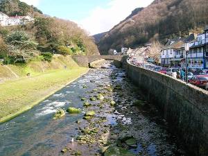
In the second picture, we see the widened river channel - the bridge is the one from which the first picture was taken.
In the left hand picture we see the road that hugs the bottom of the cliff, leading to the cliff railway and a car park.
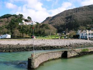
In the right hand picture, we are looking eastwards across the widened river channel onto the A39 as it climbs up Countisbury Hill towards Porlock.
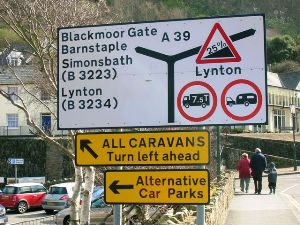
The picture of the sign was taken largely for the benefit of my children - they seemed to think it funny. Go on - see if you can guess why! The sign also gives a big clue as to why the cliff railway was a very good idea.
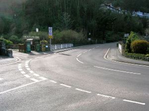
In the second picture, we are looking along the westbound A39 towareds Barnstaple and Ilfracombe, though in reality, as the A39 follows the Lyn Gorge, we are looking more or less east!
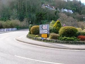
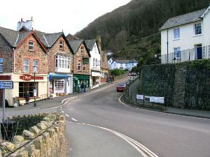
These two pictures each give a slightly different perspective on the steep hill up to Lynton. I have to confess that I am struggling to reconcile these pictures to the map and to the sign post above. I think these two pictures are of the road with the 25% gradient and the 7.5T weight limit and caravan ban on it, which the map suggests is the B3234. However, the sign in the earlier picture suggests that this is not the case. Help! I don't know!
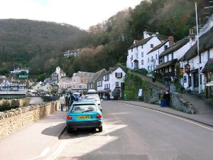
We conclude our trip along the A39 with a couple more pictures of Lynmouth harbour. The first shows the slip way, with the river channel behind it, and the second shows the smaller of the two harbour walls, which separates the harbour from the river.
Don't forget to visit the page about the cliff railway. No roads, but nevertheless, I hope you'll find it worthwhile.
Exmoor Coast - Introduction
Exmoor Coast - West from Minehead
Exmoor Coast - Porlock Village
Exmoor Coast - Porlock Hill
Exmoor Coast - From Porlock Hill to Devon
Exmoor Coast - The Impenetrable Coast
Exmoor Coast - Lynton and Lynmouth
Exmoor Coast - The Lynmouth Flood
Exmoor Coast - Lynton and Lynmouth Cliff Railway
Copyright © 2006 Simon Davies